Welcome to our Community
Wanting to join the rest of our members? Feel free to sign up today.
Sign up

Flight planning software / camera setting change

Crunchie

Member
Joined
Sep 13, 2019
Messages
7
Reaction score
0
Hi all

I am a new user of Anafi and need to be able to flightplan grids with different heights etc. I have tried the Pix4D capture flightplanning and it works well, however, it doesn't allow me (as far as I can see ) to change the photo parameters from 21MP wide to 16MP rectangular. Does anyone have experience in doing this or could you recommend another flight planning software that works with the Anafi?

Thanks in advance
Rory
 
Hi,

For my needs of doing grid photography of 200 pics with a 70% overlap of a scene, FF6 won’t do the trick, and Pix4DCapture (free) is intended to do that (and is owned by Parrot).

When I need to do so, I use the free version of Pix4D Capture. Then extract all files from the SD card to a hard drive location.
Then use Lightroom or a free alternative software to convert all your captured Raw files with the original ‘distorted’ lens Hi resolution files to simpler lower resolution file with a lens correction and ‘crop’ filter.
This operation can be automated in Lightroom to apply the lens correction and file save in any resolution you need and that should be the same in some free alternative Raw Files processing software.
If you still meet problems with that, I will try to be more ‘complete in my answer...
 
Last edited:
  • Like
Reactions: DroneSpeak CMS
There might be a simpler approach, but I’m not sure it still works after modifications both in Pix4DCapture and Anafi FF6 applications.

What used to work when Anafi kept its parameters from one startup sequence to another was :

- Start first FF6 and chose the *Photo* mode (not the movie mode)
- In the advanced settings, choose the ‘both Raw Wide and rectangular JPEG’ setting
- Quit FF6 (not long ago you could leave it open while Pix4D capture was running, now it does no longer work, it says ‘You can’t run both at the same time’... but in its own language). From what I understood, the last parameter you chose is kept by the Anafi regardless if the App is running or not.
- Start Pix4D Capture, program your mission and fly it.
- Extract the files from your Anafi memory card, there should be (at least there were) both DNG files that are Raw distorted files from the lens and the Rectangular JPEG file you are needing.

If it no longer works, use the first method I proposed with an external software...
 
Last edited:
Their might be a simpler approach, but I’m not sure it still works after modifications both in Pix4DCapture and Anafi FF6 applications.

What used to work when Anafi kept its parameters from one startup sequence to another was :

- Start first FF6 and chose the *Photo* mode (not the movie mode)
- In the advanced settings, choose the ‘both Raw Wide and rectangular JPEG’ setting
- Quit FF6 (not long ago you could leave it open while Pix4D capture was running, now it does no longer work, it says ‘You can’t run both at the same time’... but in its own language). From what I understood, the last parameter you chose is kept by the Anafi regardless if the App is running or not.
- Start Pix4D Capture, program your mission and fly it.
- Extract the files from your Anafi memory card, there should be (at least there were) both DNG files that are Raw distorted files from the lens and the Rectangular JPEG file you are needing.

If it no longer works, use the first method I proposed with an external software...
Thanks for the feedback, I have tried it and it doesn't retain the last seetings. Subsequent feedback from Pix4D Capture directly said that it uses the drones maximum resolution as a default and that cant (currently( be changed. Ive reverted to post flight distortion/resolution changes as you mentioned above. Thanks
 
With Flight Plan you need to manually compute the time intervall or distance between photos, taking into account the altitude and needed overlap. 21Mpx DNG cover 84° in width, and 16 Mpx rectangular are 75° (? see manual for exact values), height should be 3/4 of that... (so 2 * tan(α/2) * h => 2 * tan(42°) * 10 meters altitude = 18 meters width at 10 meters altitude for DNG's, is that correct ? minus the desired overlap)

Now compose your grid with 1 point at each end of line, you can see time and distance values in the middle of the green line between points. You can then click on that value to set the drone flight speed, and set the time interval between photos in FP (or select "GPS lapse" in FF6 and set the correct distance between photos (only JPEG in this case ?). I'm not sure, but maybe choosing GPS lapse in FF6 overrides the photo frequency settings of Flight Plan ?

My main issue was that the camera is not vertical, but slightly forward, despite choosing a 90° angle and slow speed of 1 m/s in Flight Plan, so every picture comes with a perspective distortion which needs to be corrected before stitching images together... with dozens of images to edit, I can't have that, and it's a loss of information.

I tried the free version Pix4D, but couldn't connect to their server after clicking on the confirmation email, and I understand it's only 15 days trial, so that's not ideal. Do you know how much they ask ? I only need 2D mapping.

Also, can you stop the drone to take the photos with Pix4D ? Image quality would be better.
 
With Pix4Dcapture (free App), you can’t stop the Anafi.
All you can do is choose slow/fast displacement of the Anafi, but no ‘pause after each image’ like you can have on other planning softwares (litchi or drone harmony but for DJI)
Next time, I’ll choose the slowest option to check what it does, and I’ll report my findings here...
 
I thought it stopped at each position took the photo and then moved on to the next position.

Sent from my LG-H873 using Tapatalk
 
I see in Pix4DCapture manual that there is a ‘Safe mode’ (I believe in iOS)


Picture trigger mode
The Safe mode and Fast mode differ as follows:

  • Safe mode: The drone stops to take every picture which significantly increases the flight time. However, the waypoints where to trigger the shutter of the camera are defined and uploaded to the drone before starting the mission. This means the drone can fly the mission without requiring a connection with the app.
  • Fast mode: The app has to send a signal message when the shutter should be triggered. This mode does not require to stop in order to take a picture but the connection with the drone should be maintained without interruption. In addition, the Fast mode does not allow to change the orientation of the camera while flying this is why all images have the same orientation since the drone translates.


Drone speed
The app computes the maximum speed the drone can have for a given overlap and flight altitude. The Fast speed corresponds to 100% of the maximum speed meaning that the speed ranges between 2 and 8 m/s. Reducing the speed might help to avoid capturing blurry images. Five types of speed can be selected:

  • Slow: 60% of the maximum speed.
  • Slow+: 70% of the maximum speed.
  • Normal: 80% of the maximum speed.
  • Normal+: 90% of the maximum speed.
  • Fast: Maximum speed.
 
... but I checked in the App, the ‘Safe’ mode is not available with the Anafi, it is available with some DJI drones (I switched to the Phantom 4 Pro and the Safe mode option is present).
It may also be related to the fact the Phantom can adjust the aperture and have a slow speed (Tv) and a ‘wide open’ aperture value (Av), as the Anafi cannot change its Av.

The possibility to stop between each picture would be nice for the Anafi. To avoid blurry images when flying low... fly slow and at an ISO value of 400 max and try to check if images are taken at 1/320s or faster.

In December 2018, the technical support team for Pix4DCapture did answer :

The Safe mode functionality is not implemented for the Anafi yet. I will share your feedback with the developer’s team so that they consider to implement it in the futur.

... seems they won’t do it...
 
Last edited:
I’ll test it in flight next week but I checked this option that states ‘Safe Mode’ is present on a DJI drone, where this option is not displayed when the ANAFI is the chosen drone.

Both my iOS iPad 4 and Android Xiaomi PocoPhone do not feature this option so it does not depend on the OS.

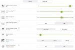
As an example below you have the very few options available for the ANAFI in the ‘Advanced’ options panel of Pix4DCapture, followed by the much more complete set of options (including the Picture trigger mode in safe mode) for the DJI phantom 4 Pro v2 at the same menu level (restart required when drone changes)

ANAFI
1C742990-1930-4FDB-877C-558107858284.jpeg


Phantom 4 pro V2
E9330979-DA1A-4C22-970F-A99FDA803E7B.jpeg
 
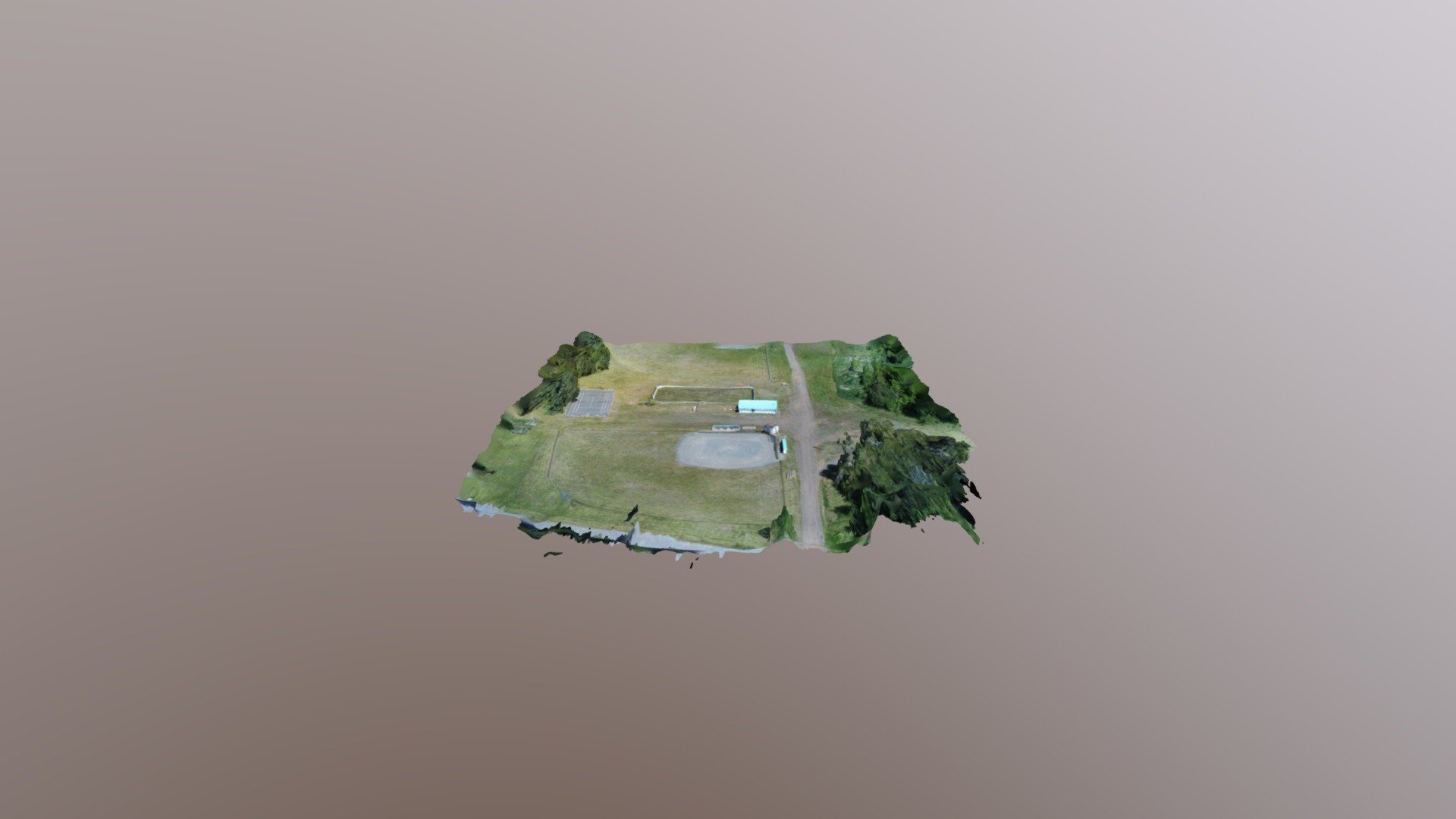
Went out this morning to see if it actually stopped to take photos. Hard to tell as it went from one spot to the other it seemed like it came to a complete stop but not for very long. Just threw together a simple render in RealityCapture BETA 1.0.
It also has a option to render a video but I had to slow it right down in post as it just zipped along at a very fast speed. LOL

Here is the render in Sketchfab

And here is the video

 
Thanks @Agustine for this interesting test.
In the advanced parameter setting for Pix4DCapture, did you opt for the slowest motion option (drone speed parameter) ?
I’ll also do some test (slow and very low to see if it stops between shots), and I’ll report here.
 
I am seeing occasional (periodic?) additional horizontal distance between some images. Not sure that I would say "missing images". While I am generally content with Pix4Dcapture, I'd like to see more consistent spacing between all images in a flight. Has anyone confirmed the most probable causes? I've seen the same phenomena with my larger Inspire 2 and the Anafi, which suggests a few possibilities, and maybe more than one (GNSS navigation adjustment between camera trigger events; processing delay with Pix4Dcapture on a new iPad with plenty of storage space; flying low (75 ft) over WiFi routers; "too much" forward overlap %). I often see 23-27 sats locked with the Anafi. 14-19 with the Inspire.

My last flight was on the Normal flight speed setting. Card is a SanDisk Ultra PLUS V10 64GB.

[As a side note, it's nice to learn that Lightroom Classic includes a camera calibration file that will detect that the images are from an Anafi. After importing the collection, CTRL+A to select all, then switch to the Develop persona. On the right side, scroll down to the Lens Distortion section. Check two settings (Enable Lens Profile, Remove Chromatic Aberration). File > Export. Be sure to uncheck settings under Metadata that would remove the EXIF GNSS location data. After climbing a learning curve with this software, it's a fast way to remove the Anafi's lens distortion from a batch of image files.]
 

Members online

No members online now.

Forum statistics

Threads
5,313
Messages
45,116
Members
8,009
Latest member
Viking