Welcome to our Community
Wanting to join the rest of our members? Feel free to sign up today.
Sign up

FreeFlight 6 Flight Plan, topography information, altitude data

Yemsky

Member
Joined
Dec 12, 2018
Messages
19
Reaction score
10
I have recently discovered the excitement of using FreeFlight 6 Flight Plans: Nothing more nerve wrecking than loosing the connection to your drone and then see it reappear with the footage you wanted on the memory card.
However, two things bug me:

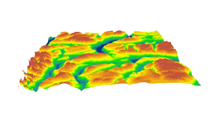
1. I don't live in a particularly mountainous region, but even setting up my first few flight plans got me to the point where I needed topography information so I can set adequate altitudes for the drone's flight path. I find it really difficult to obtain this information. The "terrain" option in Google Maps adds a bit of shading to the map displayed but does not really show usable information in any explicit measurement: There are iso-lines visible, but they do not seem to be labelled with any proper data. I read that you are meant to drop a pin, right click and obtain that data, but for me Google Maps only displays longitude and latitude information, no altitude information that would allow me to calculate how much the drone needs to climb from the take off point along the flight path. Is there a better alternative available with this information that is easily accessible, especially on an iPhone while out and about?

2. There have been a number of discussions on this forum whether it is possible to build a flight plan where your take off point is higher than some of the altitudes you want the drone to fly to; for example from a cliff down to the sea or from a mountain peak down into a valley (and back up of course). My understanding is that this is not possible in FreeFlight 6 by default. Can somebody explicitly confirm or contradict this, please.
There were discussions where some people were talking about changing the code of the Android app in a text editor. While I would not want to do this myself, as I do not have the knowledge how to, I am wondering whether any such option does exist at all for FreeFlight 6 iOS users?
In some of the earlier discussions there was talk about Parrot having announced on their developer forum that they are working on an update to the FreeFlight App that would allow this. Has there been any progress on this? I can not find this on the Developer forum, but again, that might be because I am not knowledgeable enough about the development side of this hobby.

Thank you for your help!
 
1. What I do in this case is take off and determine what is the highest object. Set my altitude accordingly.
2. That I know off, you can only do it with a text editor.
3. I honestly do not know.
 
Hello Yemsky
Share your excitement for flying Anafi with a flightplan. Always a challenge.

As I'm living in Tenerife, I'll fly most of the time in the remote mountains in the south of the Island. This here is a vertical landscape.
The Google maps as base for flighplan can be only acceptable if no big altitude changes of the terrain are to be considered and you can also find some significant points like buildings or roads as reference for setting waypoints.
Therefore here Google Maps are rather useless,
To obtain reliable altitudes for each way point and possible obstacles in between is a must. Conventional detailed topographical (paper) maps are expensive and not everywhere available, therefore I'm using the Locus app. Locus pro is primarily a rather comprehensive application for tracking your hikes or bike tours. The vector maps used are very detailed and with a cursor one can see the exact height of any location.
Basically I determine the altitude of my start, than calculate for each way point the differnce to my start point and enter this value - with a safety margin - as the height for the way point.
In all my real flights I was flying higher, (sometimes much higher :) than my start and landing position. Therefore my experience with negative altitudes is limited to a single experiment: I was flying from my roof terrace 10m down to the garage level. Had to change the altitude to -10 meter by editing the flightplan accordingly.
 
... therefore I'm using the Locus app. Locus pro is primarily a rather comprehensive application for tracking your hikes or bike tours. The vector maps used are very detailed and with a cursor one can see the exact height of any location.

Thank you. I did not know this App and just downloaded the free version from the App store and will experiment with it. The full version doesn't break the bank either, so it might be the way to go.

... my experience with negative altitudes is limited to a single experiment: I was flying from my roof terrace 10m down to the garage level. Had to change the altitude to -10 meter by editing the flightplan accordingly.

You write this very casually.... maybe I am missing the obvious: How did you edit the flightplan? Was this on iOS or Android? (I am an iOS user.)
 
Google Maps is not the right application for what you need...Google Earth is. I use it a lot for planning very accurate Flight Plans at a specific height above the varying terrain. If you zoom in with the hand icon, in the lower right you will see ground elevation and eye height. By replicating a rough track of what you have set up in Fight Plan (i.e. side by side with your smartphone) you can determine quite accurately what to set your waypoint height at. It does take some time and a little arithmetic, since the waypoint altitude in Flight Plan is only relative to the take-off elevation. You have to add or subtract the varying terrain elevation to the take-off elevation to get height of the drone above the ground. For instance, if the take-off point is 1584 meters...you want the drone to be about 50 meters above the terrain...which slopes down along your Flight Plan....so the first waypoint is at 50 meters above the take-off point...the second waypoint is supposed to be 50 meters above the terrain also , but the terrain at the second waypoint is only 1554 meters, so that waypoint's height needs to be set at 1584 - 1554 or 30 meters, or just the opposite for climbing terrain.

2. I have flown off a ridge about 50 meters down into the adjacent valley manually with no problem. I need to do the same with a Flight Plan to be sure, but I think it can be done. Just press on the waypoint until the edit window pops up and type in a negative number. One thing to be aware of is that the antenna pattern of the Anafi directly above it is really poor, so the more directly underneath it is from you the worse the reception. I had a warning when it was just 200 meters away at about 50 meters below. Take small steps in distance and negative height at first to find the limits in your terrain.
 
Thank you very much.
Google Earth is it! I forgot! I though it needed a desktop computer. Thank you for reminding me that this exists for iOS as well.

The second part of your answer sounds simple, but it doesn’t work for me: I’ve tried repeatedly to enter negative altitudes to make the Anafi climb down from the original take off altitude. For me, any negative number automatically gets replaced by 2m. It sounds like you are not suggesting this as a “should work” idea but have actually entered negative numbers successfully. Is there another setting that possibly defines the lowest altitude Free Flight accepts?

Lastly, I see your point about the signal problem when flying below the take off altitude. But I think this is only a problem in manual flight. This is exactly why I want to use Flight Path as my understanding is that the flight path data is transmitted to the drone beforehand and loosing the signal does not have an impact on the Anafi doing its thing as programmed in the Flight Path as the GPS data is received and processed in the drone (Somebody correct me if this is totally wrong, please.) This has certainly been my experience where I lost all contact with the drone and it came back having executed the full path exactly as I had entered before take off.


Sent from my iPhone using Tapatalk
 
Google Earth and lots of other good advice here.... but I would stress one thing: the best approach is to go to a location and scout it out. In the long run it will save you a tremendous amount of time on your flight plan.

Figure out the best takeoff spot and identify the tallest trees and structures relative to that spot so you can set an RTH above that. Check out the best angles, figure out where the sun is going to be, etc. Even if you just fly around a location for 15 minutes, that’s still a thousand times better (and safer) than relying on terrain data from Google Earth. Remember, the data set they pull from is pretty low resolution in most parts of the world (100 meters). And terrain data doesn’t give you the height of trees which is the real “ground” for a drone.
 
  • Like
Reactions: Joe_Scot
Thank you. I did not know this App and just downloaded the free version from the App store and will experiment with it. The full version doesn't break the bank either, so it might be the way to go.


You write this very casually.... maybe I am missing the obvious: How did you edit the flightplan? Was this on iOS or Android? (I am an iOS user.)
Sorry forgot that you are an IOS user, in the Android FF6 app a folder with the name FreeFlight 6 is generated in the root directory containing a folder flightplan, all your flightplans are stored here and can be modified with any editor.
 
Last edited:
With regard what help to use fo find the appropriate altitude.

I'm using Locus since many years and have now about 800 tracks stored. It's almost my diary. It is rather complex and takes some time learning how to use it efficiemtly, but I'm very happy to have it. For the vector maps you should download the height data as well. They will then be displayed next to the cursor.
I thought Locus is only available for Android devices?
Have now tried the Android app "Earth" but could not get any altitude information? (Opposed to what I get in Google Earth on the Windows PC)
However, even if I would get the altitudes in Earth, I still would not use it as the orientation in the mountains is much more difficult for me than when using something similar to a topogragraphic map.
 
....The second part of your answer sounds simple, but it doesn’t work for me: I’ve tried repeatedly to enter negative altitudes to make the Anafi climb down from the original take off altitude. For me, any negative number automatically gets replaced by 2m. It sounds like you are not suggesting this as a “should work” idea but have actually entered negative numbers successfully. Is there another setting that possibly defines the lowest altitude Free Flight accepts?

Lastly, I see your point about the signal problem when flying below the take off altitude. But I think this is only a problem in manual flight. This is exactly why I want to use Flight Path as my understanding is that the flight path data is transmitted to the drone beforehand and loosing the signal does not have an impact on the Anafi doing its thing as programmed in the Flight Path as the GPS data is received and processed in the drone (Somebody correct me if this is totally wrong, please.) This has certainly been my experience where I lost all contact with the drone and it came back having executed the full path exactly as I had entered before take off.

Sent from my iPhone using Tapatalk

Yes, I have not yet attempted to enter negative numbers in a Flight Plan, so you are probably correct. And you are also correct about the drones ability to complete a Flight Plan after losing signal. But if you can't enter negative numbers that is a moot point for setting up a Flight Plan below your take-off altitude. Perhaps some of the really smart people on the Forum will figure out a workaround. The only thing I can think of is to climb down the cliff. :oops:
 
... But if you can't enter negative numbers that is a moot point for setting up a Flight Plan below your take-off altitude. Perhaps some of the really smart people on the Forum will figure out a workaround. The only thing I can think of is to climb down the cliff. :oops:


Hello,
No, it’s not a moot point as you easily loose a signal due to obstacles and distance, even without climbing below your starting point. As I said: that’s why I like Flight Path in general.

Your second comment is not as “off piste” as it sounds: as long as you haven’t lost signal, one half-baked workaround could be to manually fly the Anafi to a lower altitude and set a new RTH point before executing the Flight Path. I’ll try that in a safe environment, not on top of a cliff...


Sent from my iPhone using Tapatalk
 
Google Earth and lots of other good advice here.... but I would stress one thing: the best approach is to go to a location and scout it out. In the long run it will save you a tremendous amount of time on your flight plan.

Figure out the best takeoff spot and identify the tallest trees and structures relative to that spot so you can set an RTH above that. Check out the best angles, figure out where the sun is going to be, etc. Even if you just fly around a location for 15 minutes, that’s still a thousand times better (and safer) than relying on terrain data from Google Earth. Remember, the data set they pull from is pretty low resolution in most parts of the world (100 meters). And terrain data doesn’t give you the height of trees which is the real “ground” for a drone.
Correction: DEMs have improved in the last 10 years. Still, the elevation (altitude) data is often at a resolution of 30 meters. Better than 100, but not nearly accurate enough to *reliably* use for a flight plan.

There are numerous sources of altitude data that you can download (and use in Google Earth). This article might get you started.

 
Hello all
it appears to me that there is still no real alternative to the Google Map when making a flight plan for the Anafi. Or have I missed something?.
The flight plan of the Anafi really works fine and I have to give my credit to the software developing engineers at Parrot.
The bottleneck is still the Google Map - with the little information usable in the mountains.
I'm still using the (my) archaic method that is lengthy, involves several steps and is thus prone to errors:
1. Creating with FF6 the first rough flight plan that contains all way points I'm anticipating at this time.
2. Using the Locus Vector maps, topographic maps with good altitude resolution.
I'm noting my elevation at the planned start, as well as all way point coordinates with their altitudes respectively.
3. As I'm using Android I can now take an editor to see the entries of the initial flight plan.
4. I'm now making a table for all way points that consists of
- coordinates
- Topographic elevation of the way point
- Intended height of Anafi at this point
- Difference between the start point elevation and intended drone altitude over ground, (altitude to be entered into the flight plan)
5. Compare the coordinates of the flight plan with the coordinates from the topographical map. If a significant difference exists (eg >0.0001 degree about 10m) then I correct the respective value in the Flight Plan listing.

Nb. To avoid risks like misinterpreted values or syntax conflicts. I'm just replacing the first 5 digits in the listing, leaving the (insignificant) rest untouched.

All calculated altitude values will be now edited into the flight plan listings

6. Flightplan listing now saved and checked in Ff6

It is rather complicated but I made several flights longer then 10min, up to 1.8 KM distance and at altitudes being 110 M below but also 730 M above the start points.
Would really like to have a better map than Google, to make the preparation for a safe flight simpler and also safer.
Any suggestions?
Thank you.
 
You guys may be interested in an application called "DRONELINK", it would seem to be perfect for what you guys are trying to do. However, at the moment it only covers DJI products, BUT, having spoken to the Developer, if there is enough demand for its use with "Parrot" products, then they will develop it for the likes of the Anafi.

Its a case of voting on their "Roadmap" page and giving a thumbs up for Parrot. You will find this under the table "Native App", scroll down and you will see the Parrot option.

Its a really nice product, I have been having a play doing Flight-plans and importing into Google Earth Pro. The more we get to vote, the better the chance they will include us in their development.

By the way I am nothing to do with the site or anything like that. Just a product I use with my Mavic Pro.
 
Its really an awesome idea, and I love the fact that its like working with building blocks and sharing with others..... Definitely need this for the Anafi (y)
 

New Posts

Members online

No members online now.

Forum statistics

Threads
5,295
Messages
45,053
Members
7,965
Latest member
Peanut