The forum description "Check out the new Parrot Anafi and discuss it here with your fellow Parrot Pilots!" makes me wonder out loud, is the word 'new' still applicable? Please don't read this to be mean, glib or snarky. I've never owned, nor flown any drone, but as a nerdish land surveyor have studied them over several years for mapping purposes, and am now thinking of purchasing the Anafi Extended. I wonder about this in March 2022 after being unable to find any Parrot reseller that offers a new Anafi Extended [PF728020]. So far, I've only been able to find the Anafi as used/ reconditioned/ renewed. For example, B&H is showing the Anafi Extended [B&H # PAPF728020 MFR # PF728020] as discontinued. In a followup phone call to them, B&H confirmed that it has been discontinued. Adorama, likewise, only offers used products. Both are listed as official resellers from Parrot's page Discover a Parrot drone store near you" | Parrot and none of those listed include under their respective Products listings any version of the Anafi aside from Anafi Ai and/ or Anafi USA.

Welcome to our Community
Wanting to join the rest of our members? Feel free to sign up today.
Sign up

You are using an out of date browser. It may not display this or other websites correctly.
You should upgrade or use an alternative browser.
You should upgrade or use an alternative browser.
Has Parrot confirmed that the Anafi is discontinued?
- Thread starter vkbellis
- Start date
Dirk_ANAFI
Well-known member
Related, but dated, article:

 www.theverge.com
Parrot exits the toy drone market
The French dronemaker continues to shift away from consumer sales, which are dominated by DJI
Dirk_ANAFI
Well-known member
Yes, that was confirmed by Parrot.Related, but dated, article:
Parrot exits the toy drone market
The French dronemaker continues to shift away from consumer sales, which are dominated by DJI
This is truly a shame. The Anafi is a great drone that got overshadowed by DJI, and add to it that Parrot's support went from good to okay to non-existent.
I am writing a White Paper on out of the box mapping for public safety entities and the Anafi Thermal flat out won for a solution that you fly, obtain images, process with default photogrammetry settings and do not have any idea about horizontal or vertical datums. The Phantom off course won overall when adding GCPs though.
The Anafi was 1 meter off in elevations while the DJI competitors (Phantom 4 Pro V2, Mavic 2 Enterprise, Mavic 2 Enterprise Advanced) were all wildly off due to how they report elevations and Pix4D assumes their elevations to be (Drone Deploy also had crazy elevations, long story).
The Anafi also generated more keypoints (Not necessarily more accurate ones) than all but the Phantom. When adding GCP's the Anafi's orthomap and DEM were outstanding.

@jaja6009 - Thank you for sharing. I'm most interested in the subject of your article, particularly given this juncture of Parrot's decision to stop supporting its Anafi, and your own evaluation of its effectiveness for mapping. Would it be okay to get a copy of it?
Given that the Anafi is no longer being promoted by Parrot, can you tell me if the Anafi still receives firmware updates, and if so, is there a link to the firmware's history?
The second question for you, knowing that the Anafi has been discontinued, as well as all of its various issues chronicled on this and other forums, would you still have your article's target audience of public safety entities buy one?
I'm betting you're already keenly aware of this, but GCPs are necessary for many reasons, and your article's target audience will want to do so in order to utilize the vast collections of spatial datasets tied to the NSRS. I've written about this subject over several years, the most recent was from last year. The PDF file was too large to attach to this message. If you're interested, my article on the The Vetting of Phodar 20210425.pdf is posted here:
 drive.google.com
Given that the Anafi is no longer being promoted by Parrot, can you tell me if the Anafi still receives firmware updates, and if so, is there a link to the firmware's history?
The second question for you, knowing that the Anafi has been discontinued, as well as all of its various issues chronicled on this and other forums, would you still have your article's target audience of public safety entities buy one?
If you could not buy a new Anafi, which sUAV would you buy for mapping?
I'm betting you're already keenly aware of this, but GCPs are necessary for many reasons, and your article's target audience will want to do so in order to utilize the vast collections of spatial datasets tied to the NSRS. I've written about this subject over several years, the most recent was from last year. The PDF file was too large to attach to this message. If you're interested, my article on the The Vetting of Phodar 20210425.pdf is posted here:
The Vetting of Phodar 20210425.pdf
drive.google.com
Dirk_ANAFI
Well-known member
That is also a question of how much money you will spend.
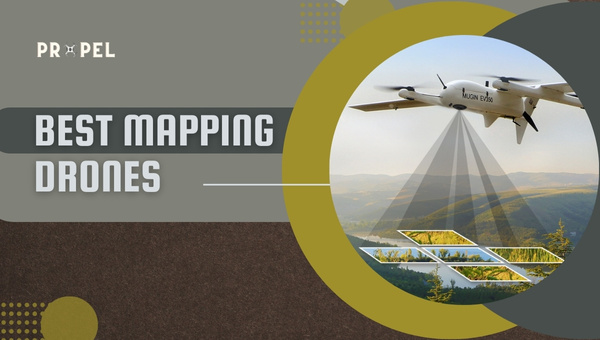
 www.propelrc.com
10 Best Mapping Drones: Drones For 3d Mapping (2025 Updated)
We have tried to make a comprehensive list of the top 10 mapping drones that are currently available in the market. We have also included a buyer’s guide.
www.propelrc.com
@jaja6009 - Thank you for sharing. I'm most interested in the subject of your article, particularly given this juncture of Parrot's decision to stop supporting its Anafi, and your own evaluation of its effectiveness for mapping. Would it be okay to get a copy of it?
Given that the Anafi is no longer being promoted by Parrot, can you tell me if the Anafi still receives firmware updates, and if so, is there a link to the firmware's history?
The second question for you, knowing that the Anafi has been discontinued, as well as all of its various issues chronicled on this and other forums, would you still have your article's target audience of public safety entities buy one?
If you could not buy a new Anafi, which sUAV would you buy for mapping?
I'm betting you're already keenly aware of this, but GCPs are necessary for many reasons, and your article's target audience will want to do so in order to utilize the vast collections of spatial datasets tied to the NSRS. I've written about this subject over several years, the most recent was from last year. The PDF file was too large to attach to this message. If you're interested, my article on the The Vetting of Phodar 20210425.pdf is posted here:
The Vetting of Phodar 20210425.pdf
When I am done the paper I will give you a copy. I am still processing all the data.
Criteria
Drones: Anafi Thermal, Mavic 2 Enterprise, Mavic 2 Enterprise Advanced, Phantom 4 Pro with PPK kit
Map: Out of Box with only checkpoints, Map with GCPs and Check Points - Processed on Agisoft Metashape
Then Out of Box Map with just Check Points, and then Map with GCPs and Check Points processed on Drone Deploy.
I must walk back the elevation statement on the Anafi. It too had very bad elevations and this was my fault for not catching it. The relative elevations are good though.
My first dataset was on Pix4D, but I have since moved over to Agisoft Metashape and am rerunning the data.
The Anafi generated more keypoints and matched keypoints than both the Mavic 2 Enterprise and Enterprise Advanced, but less than the Phantom 4 Pro V2 with PPK. The Anafi has the smallest CMOS sensor of all the drones so this was a little bit surprising, but you have to factor in that the Anafi probably compresses the JPEG better from the DNG file than DJI's cameras. And this was with the 16mp images as the Anafi can no longer use the 21mp images while using Pix4D Capture and this is a shame.
The Anafi under Pix4D Capture estimated then flew the correct height to get the desired 1.5 cm/pixel GSD as the Mavic twins were both off big time.
Part of the paper assumes that most people will just let Pix4D or Metashape use the default settings and will not change the elevation expected for the images. Of the drones tested, the Phantom 4 Pro V2 and the Enterprise Advanced actually report their elevation as above the ellipsoid and not relative to the takeoff point. But if you do not tell the software this you get wildly inaccurate elevations. The Anafi is no different as it is reporting its elevation as 44 meters over the takeoff point but the default Pix4D setting is height over the EGM96 geoid.
If you want a solid, tested mapping drone you cannot go wrong with the Phantom 4 RTK. Its proven and can do both RTK and PPK and their new single oblique flight line at the end of a flight makes it so you most of the time do not need GCPs, just Check Points.
I just bought a Phantom 4 RTK and will test it soon. I was using a custom PPK kit on a Phantom 4 Pro V2, but the added weight really took away flight time, but the data was very good.
Thanks for the link to the article.
If you don't mind I'd love to ask you a question or two in PM.
@jaja6009 - Thank you, I look forward to reading it.
Embedded image metadata - In non survey-grade aircraft, only L1 GNSS frequencies are used for 2D positioning. Altitude determinations are made using the onboard barometer. This latter point is good reason why as part of the pre-flight check, the aircraft gets calibrated at the home position for each mission. As for the datum, 2D will be WGS84, with positional errors too large to be concerned with which specific realization of WGS84 is being used. EPSG:4326 (WGS 84 - WGS84 - World Geodetic System 1984, used in GPS - EPSG:4326) is safe to consider unless the manufacturer says otherwise, but getting any of them to provide such detail has never been forthcoming. Their failure to communicate the basis of vertical datums, and moreover the limitations of such determinations is clear reason why GCPs are to be used. And if nothing else, shift the sUAV-derived point cloud into agreement with a known reliable DEM.
Geoid models have steadily gotten better and soon will be entirely predicated on gravity with staggering accuracy. Regardless of which geoid model the manufacturer uses, it's also a matter as to its resolution; think of this visually as super pixelated vs. high definition. The resolution of the model that manufacturers use plays a significant role.
Related: NGA - Office of Geomatics and GEOID Model Homepage - National Geodetic Survey (NGS)
Tangential and worth examination: Welcome | Jason
Aside from its affordability (I'm retired living below poverty level), the Anafi appears to be well suited for mapping missions used in conjunction with Pix4Dcapture. So, I'm trying to find both an affordable drone and one that works well with automated mapping mission apps. Yesterday, I heard back from Autel Robotics:
Thank you for contacting Autel Robotics.
At this time, there is no mapping application that is compatible with the EVO Lite Series.
Check your private messages, I just said hello.
That is also a question of how much money you will spend.
10 Best Mapping Drones: Drones For 3d Mapping (2025 Updated)
We have tried to make a comprehensive list of the top 10 mapping drones that are currently available in the market. We have also included a buyer’s guide.
@Dirk_ANAFI - I'm retired and living on Social Security benefits, so I have more guilt for thinking about buying a drone than money for its purchase. I realize that Parrot no longer offers support for the Anafi, but can you tell me if you are still receiving firmware updates for the airframe and / or its controller?
And you knowing all of this about the Anafi and Parrot abandoning its customers, would you still consider buying one today?
Kind regards,
Kelly
I own a Mavic Pro, a Mavic Pro 2, and an Anafi. Of the three, only the Anafi can take a full 360° spherical panoramas .. and this is a big difference in urban or mountainous situations where the Mavics slice off the tops of buildings/hills/rocks. So I'll keep my Anafi for a while yet. ")
Dirk_ANAFI
Well-known member
@vkbellis
I'm using this drone (the SAME from the beginning) since summer 2018.
My main use is "photo drone", so I fly to the desired position, make photos or videos and land again.
For this purpose the Anafi is my favorite still after 4 years.
The last firmware/software update was October 2021. I don't know of newer updates. The last one is good and safe.
Buying a new one today is a difficult question. Parrot concentrates on professional drones and leaves us consumers alone.
If you buy a new or nearly unused Anafi (no crashes!) today, you'll still have fun with it over the next years. Spare parts from crashed and defect drones will be sold for a longer time,- original spare parts maybe for several months from now on. Service or repair will be a problem now (and always was during the whole lifetime of Anafi). So if you make a hard crash, you'll probably have to buy the next Anafi or do your own repair, but that is the same for most other drones too.
But what you get is a good drone.
Your choice ...
@Dirk_ANAFI - Thank you for your thoughts and I'm happy to hear that you and others are still are so very much delighted with the Anafi.
On March 11th, I finally made the decision to not purchase the Anafi after considerable deliberation. The two tipping points were Parrot's apparent total abandonment of its customers and the $200 price drop off of the DJI Mavic Air 2 Fly More Combo. It arrived on the following Monday (14th) and by the 18th I had returned it to Best Buy due to an issue with (2) of its (3) batteries which had instantly bricked upon placement on the charging hub for their 2nd charges. The second purchase/ exchange was immediate and unquestioned at the store. Also, email messages with DJI support both during and afterwards was a positive experience. Though unproven, the bricking event of the (2) batteries I theorize may have been linked to the batteries' dissimilar firmware and the charging hub. In any case, the MA2 has been a great drone for learning to fly, and for numerous mapping missions tests using Dronelink.
On March 11th, I finally made the decision to not purchase the Anafi after considerable deliberation. The two tipping points were Parrot's apparent total abandonment of its customers and the $200 price drop off of the DJI Mavic Air 2 Fly More Combo. It arrived on the following Monday (14th) and by the 18th I had returned it to Best Buy due to an issue with (2) of its (3) batteries which had instantly bricked upon placement on the charging hub for their 2nd charges. The second purchase/ exchange was immediate and unquestioned at the store. Also, email messages with DJI support both during and afterwards was a positive experience. Though unproven, the bricking event of the (2) batteries I theorize may have been linked to the batteries' dissimilar firmware and the charging hub. In any case, the MA2 has been a great drone for learning to fly, and for numerous mapping missions tests using Dronelink.
I faced the same delima, however I ended up purchasing the Anafi 4k from BHPhoto. Upon reciept of the drone, I reached out to Parrot tech support because my iPhone was having an issue communicating with the controller. Parrot Tech support DID respond within a day and was willing to assist so I never experienced the non-existant tech support issues reported by others.
In the end, I decided to exchange it at BHPhoto instead and picked up the Anafi Extended. So far, very happy with the purchase.
It makes me wonder if the lack of support for the past year or so was due to Covid and the electronic parts shortages….
On a side note, Here’s a recent sunset photo taken with my Anafi last night and two daytime photos taking during my first flight. I expect better results the more I become familiar with the drone and recieve some filters. The sunset photo was taken using the bracketing setting of the drone and final editing was done in Afinity Photo using the HDR Merge feature.
Attachments


That's great that you received Parrot support after reading so many stories of their abandoning customers. It's also interesting that B&H had the Anafi Extended as I want to think they didn't when I was researching about a month ago.
Enjoy your new drone and happy flying!
Enjoy your new drone and happy flying!
Actually, you are correct. By the time the refund processed, they were out of stock of new Anafi 4k drones so I ended up purchasing the extended in their used department.That's great that you received Parrot support after reading so many stories of their abandoning customers. It's also interesting that B&H had the Anafi Extended as I want to think they didn't when I was researching about a month ago.
Enjoy your new drone and happy flying!
BH said more Anafi 4k’s are coming soon. It will be interesting to see if they actually do receive new stock.
Attachments
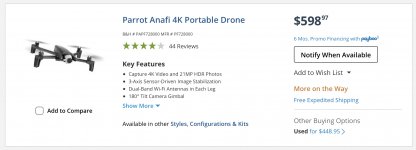
Just an FYI... Parrot Anafi is back in stock at BH Photo...
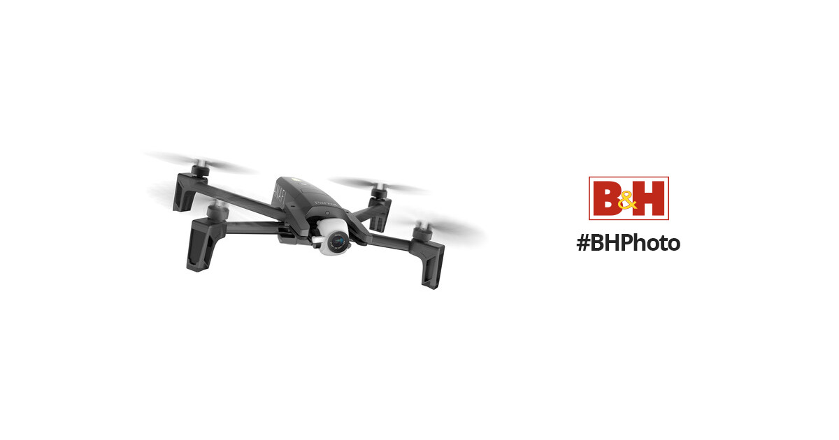
 www.bhphotovideo.com
Anafi 4k isn't dead yet.
Parrot Anafi 4K Portable Drone
Buy Parrot Anafi 4K Portable Drone featuring Capture 4K Video and 21MP HDR Photos, 3-Axis Sensor-Driven Image Stabilization, Dual-Band Wi-Fi Antennas in Each Leg, 180° Tilt Camera Gimbal, 2.8x Lossless Digital Zoom, Compact and Foldable Frame, Lightweight Carbon Fiber Construction, 16GB microSD...
Anafi 4k isn't dead yet.
it was about time since Anafis favourite feautre is to shut down mid air and drop like a stone, they really have fun doing this
It happened to me as well, battery at 41% controller 80% flying manual very clear sky drone only 50meters away and 15 meters high, suddenly it deciced to shut down and come down like a rock smashing in the pavement into 6 pieces. When i contacted parrot to my surprised they couldn't care less. I was trying to expain them that this is a very serious incident and from pure luck nobody got injured, after looking at the log files as well they just confirmed it was ä technical" issue and not a pilot error but they are afraid they can't do anything since the drone was not bought directly FROM them even though they could confirm with my invoice that it was under warranty. I mean after all what's the big deal if some anafis just shut down and fall ? even real aircrafts and helicopters can fall , so nothing serious... I purchased a mavic 2 pro which is a way better drone but most important when i broke the usb connector due to my fault they only asked for serial number, I send the controller to DJI and after 4 days i received back a brand new controller, this is a serious company that cares for its customers, unlike parrot who couldn't care less.
Parrot maybe they thought its not at all a big deal to loose a customer since they have good sales, but i assume their marketing skills are crap since they don't realize a dissatisfied customer can influence a lot of people to stay away from them
Never looking back to Parrot ever again, am sure with their poor customer service its just a matter of time when they will close down completely
Sorry to hear you had a bad experience…. If Anafi’s behave like that, how do you explain such a high review score on Amazon? Amazon.com: Parrot PF728000 ANAFI Drone, Foldable Quadcopter Drone with 4K HDR Camera, Compact, Silent & Autonomous, Realize your shots with a 180 vertical swivel camera, Dark Grey (Renewed) : Electronics
Similar threads
- Replies
- 10
- Views
- 1K
- Replies
- 0
- Views
- 3K
