Welcome to our Community
Wanting to join the rest of our members? Feel free to sign up today.
Sign up

Can you input a Lat/long to a Flight Plan waypoint?

Rocky the FS

Well-known member
Joined
Apr 10, 2019
Messages
733
Reaction score
306
Location
Hailey, ID
I'm setting up a Flight Plan to photograph a creek survey where the GPS waypoints are already determined to centimeter accuracy. I don't think it can be done from within the app, but perhaps by editing the FP file?

Oops I answered my own question a while back and forgot about it: GPS Coordinates displayed somewhere?
 
Last edited:
Yes if you are using a android you can edit the waypoints to reflect what ever you want.

Sent from my LG-H873 using Tapatalk
 
The only way that I can think of doing it is to create a rough flightplan with the correct number of waypoints and then manually adust the GPS coordinates in the flightplan .json file. However you will not get centimeter precision from the Anafi or from any civilian GPS device without dual frequency and/or augmentation as far as I know.

p.s Agustine beat me to it!
 
LIger, you bring up another question. What IS the actual accuracy of the FP waypoints and the Anafi's ability to repeatedly fly right to them on different days?

Being really anal about these sort of things I came across this interesting page:

Accuracy is the tendency of your measurements to agree with the true values. Precision is the degree to which your measurements pin down an actual value. The question is about an interplay of accuracy and precision.

As a general principle, you don't need much more precision in recording your measurements than there is accuracy built into them. Using too much precision can mislead people into believing the accuracy is greater than it really is.

Generally, when you degrade precision--that is, use fewer decimal places--you can lose some accuracy. But how much? It's good to know that the meter was originally defined (by the French, around the time of their revolution when they were throwing out the old systems and zealously replacing them by new ones) so that ten million of them would take you from the equator to a pole. That's 90 degrees, so one degree of latitude covers about 10^7/90 = 111,111 meters. ("About," because the meter's length has changed a little bit in the meantime. But that doesn't matter.) Furthermore, a degree of longitude (east-west) is about the same or less in length than a degree of latitude, because the circles of latitude shrink down to the earth's axis as we move from the equator towards either pole. Therefore, it's always safe to figure that the sixth decimal place in one decimal degree has 111,111/10^6 = about 1/9 meter = about 4 inches of precision.

Accordingly, if your accuracy needs are, say, give or take 10 meters, then 1/9 meter is nothing: you lose essentially no accuracy by using six decimal places. If your accuracy need is sub-centimeter, then you need at least seven and probably eight decimal places, but more will do you little good.

Thirteen decimal places will pin down the location to 111,111/10^13 = about 1 angstrom, around half the thickness of a small atom.

Using these ideas we can construct a table of what each digit in a decimal degree signifies:

The sign tells us whether we are north or south, east or west on the globe.
A nonzero hundreds digit tells us we're using longitude, not latitude!

The tens digit gives a position to about 1,000 kilometers. It gives us useful information about what continent or ocean we are on.
The units digit (one decimal degree) gives a position up to 111 kilometers (60 nautical miles,
about 69 miles). It can tell us roughly what large state or country we are in.

The first decimal place is worth up to 11.1 km: it can distinguish the position of one large city from a neighboring large city.

The second decimal place is worth up to 1.1 km: it can separate one village from the next.

The third decimal place is worth up to 110 m: it can identify a large agricultural field or institutional campus.

The fourth decimal place is worth up to 11 m: it can identify a parcel of land. It is comparable to the typical accuracy of an uncorrected GPS unit with no interference.

The fifth decimal place is worth up to 1.1 m: it distinguish trees from each other. Accuracy to this level with commercial GPS units can only be achieved with differential correction.

The sixth decimal place is worth up to 0.11 m: you can use this for laying out structures in detail, for designing landscapes, building roads. It should be more than good enough for tracking movements of glaciers and rivers. This can be achieved by taking painstaking measures with GPS, such as differentially corrected GPS.

The seventh decimal place is worth up to 11 mm: this is good for much surveying and is near the limit of what GPS-based techniques can achieve.

The eighth decimal place is worth up to 1.1 mm: this is good for charting motions of tectonic plates and movements of volcanoes. Permanent, corrected, constantly-running GPS base stations might be able to achieve this level of accuracy.

The ninth decimal place is worth up to 110 microns: we are getting into the range of microscopy. For almost any conceivable application with earth positions, this is overkill and will be more precise than the accuracy of any surveying device.

Ten or more decimal places indicates a computer or calculator was used and that no attention was paid to the fact that the extra decimals are useless. Be careful, because unless you are the one reading these numbers off the device, this can indicate low quality processing!


Now the Json file Lat/Long has 14 decimal places (!). That is equivalent to about the diameter of a Proton. Absurd! When I look at the satellite page of any of my GPS's I see a best accuracy of about 10 feet. I'm guessing that the Anafi would not better that. That means that although the FP waypoint might have an accuracy of 1/10th of a meter the Anafi could not fly to that accuracy. This likely explains why the RTH may not get right over the take-off zone. Leave aside the Precision Landing feature because that uses the belly cam and it needs a high contrast landing spot.

I think this would be an interesting test: Create a simple Flight Plan along the sides of a rectangular field with a 15 second pause at each corner at a 20 foot altitude and place a pail or a rock at each corner that you can photograph from vertically above. Fly the plan, take the photos and see how accurate the photo is. Do it again from 10 feet. Now come back a few days later and do it all again!

I'll report the results as no-one else here probably cares a whit! ;)
 
Last edited:
Results: I flew around four corners of my rectangular corral and took a photo of the post at each corner at about the middle of a ten second pause from 22 feet in a light breeze. First time around I had trouble getting the camera to stay in photo mode and was a bit late on some shots so I disregarded that one. The next two showed a maximum displacement of four feet and a minimum of two feet for each shot in the series. I'll bet if I was at 50 feet you would hardly notice. Now to do it again in a day or so and do four circuits. I should also remember to look at the number of sats next time.

Pretty darned accurate and a lot better than I would have expected from years of experience with Garmins! (y)
 
  • Like
Reactions: yarrr
When doing Photogrammetry a 1m margin of error if you don't have a RTK drone, is acceptable and I have found the Anafi to be pretty close.

It will be interesting to see your results over time.
 
Yeah, one meter is more than acceptable for the survey I mentioned above. This thing continues to amaze me. I'll do this FP test every couple of weeks until it's too cold. (For me, that is.)
 
That is an interesting article Rocky. It explains the accuracy of Lat and Long figures but does not mention the accuracy, or should it be inaccuracy, of the Lat/Long data from the GPS module. Your test in your corral will show the repeatability of the figures but unless you know the exact position of the corners it will not show the error of GPS against actual Lat/Long.

If you knew the accurate Lat and Long of a spot could you place the Anafi on the ground with the its GPS directly above the known spot and take a photo? If you then examine the exif data of the photo you should find out how far off the GPS is. Doing that on different days with different satellites in view would build up a picture of the error. You would have to let the Anafi sit for a while before taking the photo to let it see as many satellites as possible and reduce the error.
 
....unless you know the exact position of the corners it will not show the error of GPS against actual Lat/Long....
And that opens up a whole 'nuther can o' worms! I have USGS topos on disk but since my house was built long after that survey I can't correlate any post. Then there's the NAD27 to NAD 83 or WGS84 question. I can get pretty accurate subdivision plats from the county and find the corners of the lot but then how do I know the surveyors were accurate? I CAN find some nearby benchmarks and look them up in the USGS database; that is probably the most accurate points I can use. Then I have to do the conversion to WGS84 which I'm pretty sure the Anafi uses. Then I have to actually locate the benchmark, put the drone on it, fly it up 20 feet and back down, then look at the json and correlate that to the benchmark.......

This is beginning to look like a wormhole not a can of worms! :eek: I think I'll live with 1-2 meter accuracy since my end result will always be a photograph...if it shows what I expect all is good. ;)
 
I had my first crash with the Anafi using FP. It wasn't damaged, still flies and takes pictures ok.
At first I thought it was an accuracy thing, that's why I posted in this thread.
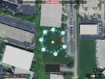
I was in an open field with a circular flight plan, the POI was in the center. A row of bushes were left of the waypoints. Because the point of interest is in the center of the circle, I have no video of the bushes when it hit. It looked like enough space to clear the bushes when I made the FP on the Ipad mini screen, but no.... it wasn't.

After looking at the FP in retrospect, I see, sure enough, the row of bushes were in the flight path. Sheeez. Color me stupid.

I found the Anafi easy enough, it was doing some kind of beeping thing telling me I crashed. The on/off switch didn't seem to respond, so after I removed the battery and put it back in, everything appeared normal.

So far I'm 0 for 2 tries in getting a successful FP.

1568785703793.png

My next flight plan will only have one waypoint in the center of the field. I will see if Murphy's law can screw that up.
 
Last edited:
This is beginning to look like a wormhole not a can of worms! :eek: I think I'll live with 1-2 meter accuracy since my end result will always be a photograph...if it shows what I expect all is good. ;)
I tend to over think things instead of just doing it but I do not like making mistakes (repairs to my planes take ages!). As they say "The proof of the pudding is in the eating" and if the photos/videos turn out as you want then why worry about the accuracy of GPS? If you really cannot sleep at night look at Uncertainty Budgets as a way of itemising the errors. I had to create some when I was working and they are dull.
 
....After looking at the FP in retrospect, I see, sure enough, the row of bushes were in the flight path. Sheeez. Color me stupid.
There is one thing that GE will not do while creating a flight plan and that is determining the height of any obstacles. Only visual inspection in the field can do that. You are definitely not the first to make that mistake. Added to that is the difficulty of creating a Flight Plan on the tiny screen of a smartphone. Using TeamViewer helps a lot in that regard since positioning the waypoint with a mouse is more accurate.

Glad you hit a bush instead of a tree! But have a close look at the props for damage.
 
...It will be interesting to see your results over time.
I did the FP over again today and the results were the same, about 1-2 meters off at most. I did notice that the Anafi often overshot the waypoint by about a meter, then backed up. I think that is related to the leg speed. For anyone doing this sort of vertical photography over a specific small ground feature a ten second pause gives enough time for the drone to stabilize before you snap the photo.

As an aside, I tried hand landings again with the technique of pushing the button first before putting my hand out. That seemed to work better but still the drone didn't shut down quite as fast as I would like all the time.
 
  • Like
Reactions: MustangPhil
That is an interesting article Rocky. It explains the accuracy of Lat and Long figures but does not mention the accuracy, or should it be inaccuracy, of the Lat/Long data from the GPS module. Your test in your corral will show the repeatability of the figures but unless you know the exact position of the corners it will not show the error of GPS against actual Lat/Long.

If you knew the accurate Lat and Long of a spot could you place the Anafi on the ground with the its GPS directly above the known spot and take a photo? If you then examine the exif data of the photo you should find out how far off the GPS is. Doing that on different days with different satellites in view would build up a picture of the error. You would have to let the Anafi sit for a while before taking the photo to let it see as many satellites as possible and reduce the error.


My reply:
"And that opens up a whole 'nuther can o' worms! I have USGS topos on disk but since my house was built long after that survey I can't correlate any post. Then there's the NAD27 to NAD 83 or WGS84 question. I can get pretty accurate subdivision plats from the county and find the corners of the lot but then how do I know the surveyors were accurate? I CAN find some nearby benchmarks and look them up in the USGS database; that is probably the most accurate points I can use. Then I have to do the conversion to WGS84 which I'm pretty sure the Anafi uses. Then I have to actually locate the benchmark, put the drone on it, fly it up 20 feet and back down, then look at the json and correlate that to the benchmark.......

This is beginning to look like a wormhole not a can of worms! :eek: I think I'll live with 1-2 meter accuracy since my end result will always be a photograph...if it shows what I expect all is good. ;) "

So, having nothing better to do and wanting to fly the Anafi some more before winter set in, I decided to do just exactly that. First I found a benchmark and looked up its datasheet, made the conversion from NAD 83 to WGS 84 and manually created a waypoint on my Garmin GPS. Then I drove by the benchmark and checked the Garmin accuracy. It was about a meter off. Next, I created a waypoint in my backyard on the Garmin, turned on WAAS, then visually created a Flight Plan with one waypoint in approximately the same position, edited the savedplan.json file to be exactly the same hh.ddddd numbers as the Garmin waypoint numbers, saved it and went off to test.

First I took the Garmin out to the waypoint in the back yard and let it sit for several minutes. It showed a 7 foot accuracy, but the waypoint kept moving around a little at a 20 foot zoom level, the highest available. Then I flew the Anafi Flight Plan and it hovered about a meter from the GPS. Not bad. Then I looked at the GPS and saw that the pointer had moved about a meter. I moved the GPS again so that the pointer was directly over the waypoint and looked up. The Anafi was hovering a couple feet over my head, only 2 feet from the GPS! The Anafi did not move an inch during this whole test in calm air.

I'm going to do this over a few times since all the computations have already been done and it only takes about five minutes to replicate. I'm also going to take the GPS to the benchmark a few more times to see if that one meter inaccuracy stays the same. It's really better than I expected.

Since I'm going to be creating waypoints to photograph with the Garmin GPS, it isn't really important that my GPS or the Anafi is a couple of meters from a physical Lat/long. It IS important that the Anafi Flight Plan waypoint is within a meter or less of the Garmin waypoint, and I now believe that if I edit the FP waypoints in the Savedplan.json to be identical to five decimal points with the Garmin it will be. (I just put about 10 zeros at the end so the number of decimals is identical to the original). Pretty amazing if you think about it for a consumer drone!

Most of the time I won't really need this level of accuracy, but it's pretty cool to know that it is available.
 
  • Like
Reactions: Dirk_ANAFI
So after mulling this over for a few days, I decided to make another test. Without changing the FP waypoint, I flew over to it and stuck a flag under where the Anafi was hovering. I could see on the display that the Anafi was not exactly over the waypoint, but it was hovering where it thought the waypoint was.

Then I repeatedly flew it away a few hundred feet in several different directions and started the Flight Plan again. Each time it came to a hover within a meter of the flag, but in several different directions from it. I therefore believe that the 2 foot accuracy stated above is not correct. The difference between the accuracy of either the Anafi or the Garmin is that they both exhibit 1-2 meter accuracy, but once the Anafi is in a hover over where it thinks the waypoint is, even if it's 2 meters west of the flag, it will not move.....whereas the Garmin pointer is moving randomly around the flag when you are standing still over it and the waypoint. I did get back to the Benchmark and the Garmin did the same thing, sometimes within a couple of feet and others up to 12 feet away over a 20 minute interval.

I suspect this ability of the Anafi to hover so steadily is due to the gyroscopes and not the GPS. So then I tested RTH several times and the result was identical to past experience: Sometimes the Anafi would return to within 2 feet of the take-off point and other times it would be 6 feet away. (This is with Precision Landing activated).

So if one is trying to take vertical photos of a series of objects that have Lat/Long's determined by a GPS, it would help the accuracy to match the Flight Plan waypoint Lat/Long's to the GPS Lat/Long's, but the best one could expect is 1 meter accuracy, and sometimes worse. From 50 feet up, this is irrelevant....the photo is going to show the object just fine.

So now I have answered my own question in the fourth post. It is 1 meter about 75% of the time and 2 meters the other 25% with good satellite reception. With a poor satellite constellation it could be much worse.

(It turns out that using a USGS Benchmark is somewhat irrelevant to the discussion unless you are actually trying to locate a Benchmark with either the GPS or the Anafi because you can't find it visually. Any convenient GPS waypoint will do and if you match the Lat/Long numbers in the Flight Plan manually the Anafi will end up within 1 meter most of the time).

Whew.....good thing I'm retired. ;)
 
  • Like
Reactions: kimber45

New Posts

Members online

Forum statistics

Threads
5,295
Messages
45,052
Members
7,965
Latest member
Peanut