Welcome to our Community
Wanting to join the rest of our members? Feel free to sign up today.
Sign up

Show Anafi Log Project

You refer to tab "Attitude"? All other charts are in degrees.

I refer to the columns angle_phi, angle_ theta og angle_psi that appeared to be given in radians and not degrees.

I suppose the values indicate the copter's slope in the air and then the way it flies. Strangely enough, I think two abandons should be enough and therefore I cannot guess the meaning of the third.

Regards, Leif.

Those are the Euler angles that translate to body angles (in radians).
 
Last edited:
  • Like
Reactions: Landbo
Those are the Euler angles that translate to body angles (in radians).

Thanks for the info. By reading in Helmut nice manual, I can read that angle_phi is Anafi compass direction. None of those tree values can people usually understand when they are given in RAD but make good sense in degrees.

Regards, Leif.
 
I refer to the columns angle_phi, angle_ theta og angle_psi that appeared to be given in radians and not degrees.
In the table I like to see what comes in from JSON file. Originally it is radian. This seems to be the common use and was defined by developers of MAVlink message format. For analysis it is better to changes as less of possible the original data.

Also in attitude chart I kept the angles in 'rad'. Two reasons:
- to estimate the behaviour of the bird the measure untis are not really important
- Compass heading in degrees will have 0..360° which destroys the pitch roll view (too small then). A third axis makes it not better, more confusing I guess.

If you click on the header of the column you will get the chart in degrees.
If you hold the mouse on a cell in the table you will also get the value in degrees.

br HE
 
I had a failure just after Christmas and the drone fell out of the sky from 100m(under warranty/replaced). I was doing the 360 panorama and i've checked the flight on your program and still cant find any reason why it failed.

I would like to have an own thread for problems during flight. This one is dedicated to the tool itself.
----------------------
The JSON file shows the flight to the last point and the begin of the panorama action there. Then, suddenly the telemetry ends. This seems to be a total power loss without any indication before. Battery is good, no alarm indication, GPS is good. It stops with no reason, possibly a HW error.

More information may be shown in the FDR log files stored in the copter itself. I have no documentation how to read this.

br HE
 
Last edited:
None of those tree values can people usually understand when they are given in RAD but make good sense in degrees.
You won. Now you can select angle as degree also in the data table.
 
Last edited:
  • Like
Reactions: Landbo
Much appreciate your frequent improvements!

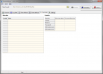
I realise that for some reason I never see any data in the Meta data box (it is completely white with no rows, columns or data) whilst the Statistics box shows values as expected. Not sure if this is just me - or if anyone else sees this issue?

Regards Joe
 
I could not provoke this problem. If I change someting in the meta data in the original JSON file the JSON parser will detect this and complain about wrong or missing data. This sounds strage, if all went well but only the meta data table is missing.
What OS do you use? LINUX, Winows 8, 9, 10?

You can try to delete the file "ShowAnafiLog.xml" to reset the application to default. You will lose all your setting but there are not so much.
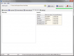
If you start this application the it should look like this:
Screen_Meta data_1.png
Would you please try to test this?

br HE
 
I use your program on 2 PCs - one with Win 7 and one with Win 10 - and I see the same on both.

I deleted the XML file as you suggested and on re-opening the program can confirm that I do see the same as you on startup (with the Meta data box having rows and columns, but blank).

1681


However, as soon as I load any JSON files (I have 56 in the folder) then I get the totally blank white box as you see below...

1682


It does seem weird. Not a big deal, as your program is great anyway, but I suspect you will be able to solve it somehow!

Thanks
Joe
 
Can I get one of those files where it happens? Are all your files are affected?

br HE
 
@Joe_Scot: Would you please double-click on the mete-data-table? Google Maps should be opened with the homepoint.
Just to check if there is (hidden) homepoint or if this is empty.
 
@Joe_Scot: Would you please double-click on the mete-data-table? Google Maps should be opened with the homepoint.
Just to check if there is (hidden) homepoint or if this is empty.

Ah yes - data must be in the table, though invisible!! When I double click on the table it does indeed open Google Maps to the correct point. (Yes - all of the JSON files are affected in the same way... I have never seen anything appear in the Meta data table)

Would you still like me to provide a JSON file? If so, how best to send it to you?

Thanks
 
OK, data are there. When you click into the table, will cells appear, means redrawed?
I will make a version to force redrawing the controls.
 
OK, data are there. When you click into the table, will cells appear, means redrawed?
I will make a version to force redrawing the controls.

When I double click on the table it does open Google Maps BUT the table remains as a white square - nothing visibly changes.
 
I have uploaded a new version that forces repaint the tables. Please download and try again.
I cross my fingers....

With the new version you can toggle the Charts attitude between All -> Only XYZ speed -> Only XYZ angle -> Only Nick/Roll angle -> All again by dounle click on the selection box below.

(Mostly) Good news! I see data in the Meta Data table!!

However, when I downloaded your new version, (and deleted the previous XML file for good measure) there was no change ... still an empty white box.

So .... I tried something else - I tried it with a folder containing just a sample of 4 of my JSON files - and then everything is fine!

I copied back ALL of the JSON files (56) and again I see only a white box (when viewing any of them).

Therefore perhaps at least one of the JSON files is somehow corrupt and that is affecting the display of the meta data for ALL entries.

I will test to see if it is just one problemmatic JSON file and if so, what is wrong with it!

Sorry but cannot do it just now - though I wanted to let you know that the problem is probably not in your program!!

Thanks for your help, and will post again when I test all the JSON files
 
If you can find the file that makes problems, I would like to have it. It may help to make the progam harder against such things.
You can e-mail it to me as zip file. The e-mail address is at the bottom of the last page in the PDF file (manual).

br HE
 

Members online

No members online now.

Forum statistics

Threads
5,318
Messages
45,170
Members
8,032
Latest member
schaefer73