Welcome to our Community
Wanting to join the rest of our members? Feel free to sign up today.
Sign up

Flight plan for Parrot Anafi online

Thanks a lot to you @abant and congratulations for your WebApp.
...
Thank you.
In all documents regulating the use of drones, it always refers to the height of the flight above ground level (AGL), so I use a generally accepted rule. And you are right, this altitude is set relative to the take-off point.
As for changes in the height of the earth's surface, this can be done, but the Elevation API of Google is not free unlike the Google Map.
 
Question:
Would you release the birds from your 119/120m height restriction, please?
:devilish:
In most cases, a flight height of more than 120 meters is not required, in addition, it is illegal in Europe. But I agree that the ability to disable this restriction is required.
 
  • Like
Reactions: Ana789

To me (and I think according to aviation rules also as a private pilot), a Flight 'altitude' is always refered as AMSL (Above Mean Sea Level or QNH) and 250 m is perfectly legal (I live at 198 m of altitude).

A 'Flight height' of 250 m (heigth means Above Ground Level - AGL or QFE) and this is illegal.

I may be wrong though, but the words height and altitude have very different meanings in aviation.
Sorry we do not understand each others.

Too bad the altitude (AMSL) of the Way Point is not a free option that you can use, I understand there is a paying fee to access this option in an API...
 
I'm sorry, but I don't speak English and I use an online translator. The differences in English terms are not known to me. So "altura sobre el terreno" is "Flight height "in English, not "Altitude"? OK, I'll make corrections. Please let me know if you see any other errors.
 
...
To me (and I think according to aviation rules also as a private pilot), a Flight 'altitude' is always refered as AMSL (Above Mean Sea Level or QNH) and 250 m is perfectly legal (I live at 198 m of altitude).

A 'Flight height' of 250 m (heigth means Above Ground Level - AGL or QFE) and this is illegal.

I may be wrong though, but the words height and altitude have very different meanings in aviation.
[...]
He changed it already!

And Phil, we are flying UAV's, not Airplanes
;)
Most people look at the flight height from where you start the drone
Because THAT is the height you see in the flight controller App as "0"
You don't have another option, right?
And UAV flight height has in most countries nothing to do with "above sea level"
(except in Singapore, where it is max. 60,96m / 200ft AMSL. My birds are (have been) set to 50m there! So I don't need to calculate always new ;-)

I could even fly here legally about 400m up from starting point (90m max altitude) , if I chose the HP on the bottom of a hill and fly that slope uphill.
(And that is only the limit b/c of the VLOS ? )

Actually that way I found out, that the Anafi was released from the 150m limitation, after the last update in 2019. Just by accident.

Litchi calls it just altitude, so flight height, like it is now, should not confuse anyone.

Thanks for the quick changes, Abant
 
  • Like
Reactions: MustangPhil
No problem, I am not an English native speaking guy either, but I think the correct term you should use is "Height" (Above the ground) and not "Altitude" (Above Mean Sea Level).
If any "real english speaking telepilot" could confirm that would be great.

Edit : I've just seen your post @Ana789, and the new set of European rules for drones will be intended to separate Drones/Airplanes flights at 120 m height. The terms are the same and should not confuse anyone... (I confess I flew 350 hours of light aircrafts and only 100 hours of drones ... but recently qualified in France as a professionnal telepilot, and during the exams, the difference between heights and altitude is the basis of all discussions ;0)

... anyway ... @abant work is amazing !!
 
Last edited:
  • Like
Reactions: Tasos Delaportas
Seems to me that "Flight height, m" in the software "Flight plan generator for "Parrot Anafi"" is calculated from the starting point.
If going up a hill you have to compensate by adding meters to "Flight height:".
 
Last edited:
Seems to me that "Flight height, m" in the software "Flight plan generator for "Parrot Anafi"" is calculated from the starting point.
If going up a hill you have to compensate by adding meters to "Flight hight".

Yes, you are right, that’s what we are obliged to do.

That’s why I was asking for an ‘automatic way’ to add the terrain elevation variations to each waypoint (in a survey or photogrammetry mission, you may have 200 points).

@abant could do it buy adding this variation (WayPoint Altitude - Take-Off Altitude), but if I understand well, it’s not a free option in Google Earth API.
Could there be a possibility to get this Free ‘Z’ information via another source than Google ? for example here : Open Topo Data

Thanks for your already impressive job !

Have you tried the "Litchi 2 Anafi" Mission proggy, CSV2JSON?

For Litchi to create a mission "above ground", you just need to get an api key.
And to use your key in Litchi
The problem is: You just have a "couple" (25000 a day, I think, I should check my "bill" from google ;-) for free. Which is no problem, if you use your key for yourself.
To make an "above ground" flightplan possible, abant would need to use HIS api key and risk, that some people would try to extend this number.

So he would need to open his website to us users, so that we all would use OUR api key for the flightplans.
Not sure if that is an easy task!
 
  • Like
Reactions: MustangPhil
Have you tried the "Litchi 2 Anafi" Mission proggy, CSV2JSON?

Thanks for pointing me to this thread ! (In which I posted !!! But forgot...)
I’ll have a look at Litchi hub ....
 
Thanks for pointing me to this thread ! (In which I posted !!! But forgot...)
I’ll have a look at Litchi hub ....
You'r welcome!

Just dont forget:
The ability to gain height is a speed sensitive task.
Since now I had no chance to try to find the best solution , meaning: How high is the max forward speed to still get the most ascend/descend for, lets say, a 45 degree movement.
Can our bird do 4m/s vertical during 4m/s horizontal?
What is the max horiziontal speed, to get 2 or 3 m/s vertical out of it?
So much to do but not at the right location for it, somehow
 
  • Like
Reactions: MustangPhil
Hello everybody!

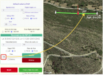
Now you can change the parameters of each point separately. In addition, the point marker shows the orientation of the drone. Don't forget that yaw is measured counterclockwise.

1591003098522.png

Each point is added to the flight plan with the values specified in the "Default values of WP" fields.
To change the point values, click on it and make changes in the "Values of WP" fields. Click "Save".

I just finished checking the new functionality and fixed all the errors I found, but I can't be sure that I found them all.
Please report any errors you find.

How it works:
1591008527352.png 1591003694886.png 1591003858057.png

Unfortunately, I don't have the option to check the flight plan for iOS.

Links:
Español
Русский
English
 
Last edited:
  • Love
Reactions: zandoli
It looks very good. Although I have not used the application I admire the work that has gone into it.

Just one comment and that is that in the "Values of WP" table the text is in Spanish even though I have selected English for the language.

Could I request that the waypoints are numbered on the map so that it is easy to see which way round the flightplan goes. Also is there any way to insert a new waypoint between 2 existing waypoints? A way of importing previously saved flightplan into the application would also be nice if it is possible.
 
Could I request that the waypoints are numbered on the map so that it is easy to see which way round the flightplan goes.

The point ID is displayed when you select a point:
1591009360500.png

Also is there any way to insert a new waypoint between 2 existing waypoints?

Unfortunately, no. You can drag points to new positions and delete them.

A way of importing previously saved flightplan into the application would also be nice if it is possible.

At the moment, I don't plan to do this. In addition, I do not think that re-creating a flight plan on a site page is much more complicated than the import procedure.
 
[...]


At the moment, I don't plan to do this. In addition, I do not think that re-creating a flight plan on a site page is much more complicated than the import procedure.

That is entirely depending on the effort you put into a flightplan.
Since it is easier to correct wrong height's/positions/angles/radius/...., AFTER you flown the plan the first time, at a computer than in FF6, it would be really nice to have that option.

Even more since I found out that a created flightplan will be usable for another location, as long it is still in your generator and you just set the view point at the new location.
Which means that setting up some "universal" missions and just changing them in height, speed, radius, for another location, could be off help on a flight location
(ok, not working for points!)


Honestly, if the anafi (mine at least) would execute the flight plans in a progressive way, it would be just perfect.
But this is for Parrot to correct!
 
OK, I'll think about it. But this is not an easy task, and most likely, the user's authorization on the site will be necessary.
 
Don't worry about it!
It would be a "nice to have", but is not a "need to have".
In my eyes at least
And in special for some flightmodes that we never would have learned about without your work.

-Give somebody an inch, and he will (try to) take a mile.-
 

New Posts

Members online

No members online now.

Forum statistics

Threads
5,312
Messages
45,102
Members
8,014
Latest member
clansman320