It has been a long time since I started working on the project, so to get information about working with the app, I recommend reading the "Help" page.
--------------------------------------------------------
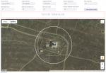
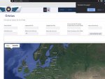
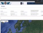
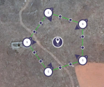
On this page, you can create a flight plan for Anafi in the form of an orbit around the POI. The page is in two languages - Spanish and Russian.
After entering all the data, you get a zip archive.The archive contains two files: "savedPlan.json" and "screenshot.png"
If you are using an Android device, unpack the archive to the "sdcard/Free Flight 6 /flightPlan" folder. I don't know the file format for iOS, so I'm not sure it's exactly the same.
After unpacking the archive, a new flight plan will appear in FreeFlight 6.
I didn't have a chance to experience the result. If anyone tries it, I would appreciate your feedback.
Versión española
Русская версия
Englisn version
--------------------------------------------------------
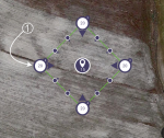
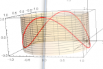
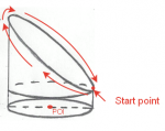
New flight plan model. Flying in a vertical spiral for shooting tower-like objects.
Versión española
Русская версия
English version
---------------------------------------------------------
If you have the opportunity to do so, please upload the video that you shot while using the generated flight plan, indicating the parameters of the plan. This will help other users correctly select the necessary parameters.
Remember that before starting a flight, you must check all the parameters of the plan: the position of the points, the height and speed at each point. Make sure that there are no objects in the flight zone that can become an obstacle.
--------------------------------------------------------
On this page, you can create a flight plan for Anafi in the form of an orbit around the POI. The page is in two languages - Spanish and Russian.
After entering all the data, you get a zip archive.The archive contains two files: "savedPlan.json" and "screenshot.png"
If you are using an Android device, unpack the archive to the "sdcard/Free Flight 6 /flightPlan" folder. I don't know the file format for iOS, so I'm not sure it's exactly the same.
After unpacking the archive, a new flight plan will appear in FreeFlight 6.
I didn't have a chance to experience the result. If anyone tries it, I would appreciate your feedback.
Versión española
Русская версия
Englisn version
--------------------------------------------------------
New flight plan model. Flying in a vertical spiral for shooting tower-like objects.
Versión española
Русская версия
English version
---------------------------------------------------------
If you have the opportunity to do so, please upload the video that you shot while using the generated flight plan, indicating the parameters of the plan. This will help other users correctly select the necessary parameters.
Remember that before starting a flight, you must check all the parameters of the plan: the position of the points, the height and speed at each point. Make sure that there are no objects in the flight zone that can become an obstacle.
Last edited:


