Welcome to our Community
Wanting to join the rest of our members? Feel free to sign up today.
Sign up
You are using an out of date browser. It may not display this or other websites correctly.
You should upgrade or use an alternative browser.
You should upgrade or use an alternative browser.
Flight plan for Parrot Anafi online
- Thread starter abant
- Start date
You can save the file to your computer and use it in video processing programs, such as Davinci Resolve. I changed the link parameters, now the browser will immediately suggest that you save the file instead of opening it.@abant
I was looking over the Anafi luts and when I click on the download link all I get is text. How do you use them?
zandoli
Well-known member
- Joined
- Jul 8, 2018
- Messages
- 157
- Reaction score
- 87
"Static Yaw" - the new "Points" flight plan property.
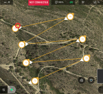
As you know, by default, FreeFlight 6 creates a flight plan with the "Constant course" option disabled. This means that if two neighboring points have different Yaw, the drone will rotate smoothly throughout the entire segment when moving from point to point. For example:
View attachment 4128
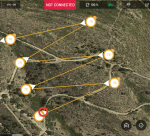
When "Static Yaw" is activated, the rotation angle will remain unchanged as you move from point to point. This can be useful when performing various tasks, such as surveying or mapping.
View attachment 4129
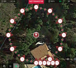
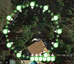
To use this mode, set:
View attachment 4130
How difficult would it be to add a checkbox which would 'reverse flight plan leg'?
I am not sure how useful it would be for others.
AnafiPilot1
Well-known member
- Joined
- Aug 15, 2019
- Messages
- 500
- Reaction score
- 385
You can save the file to your computer and use it in video processing programs, such as Davinci Resolve. I changed the link parameters, now the browser will immediately suggest that you save the file instead of opening it.
They are downloading as html files, so you will need to change the extension to .cube
It's not difficult, just one line in the code.How difficult would it be to add a checkbox which would 'reverse flight plan leg'?
I am not sure how useful it would be for others.
I changed the link parameters, now the browser will immediately suggest that you save the file instead of opening it.They are downloading as html files, so you will need to change the extension to .cube
zandoli
Well-known member
- Joined
- Jul 8, 2018
- Messages
- 157
- Reaction score
- 87
On Android devices and on a Windows computer I can't get the problem. Try refreshing the page.
The map for Points does not load for me when using Firefox and Edge on Windows 10.
It loads when using Chrome.
edit- Took a while to load with Edge browser. Refreshed the page and same behavior... does not load.
Last edited:
I have the same problem with Safari on Mac. Orbit , spirals and trefoils works perfectly but not points.The map for Points does not load for me when using Firefox and Edge on Windows 10.
It loads when using Chrome.
I'm not sure about Safari, but I think I fixed the problem. At least FireFox, Edge, Chrome, Opera, Brave, and Yandex load maps at once.I have the same problem with Safari on Mac. Orbit , spirals and trefoils works perfectly but not points.
Hi,I'm not sure about Safari, but I think I fixed the problem. At least FireFox, Edge, Chrome, Opera, Brave, and Yandex load maps at once.
Thanks a lot, points works great with Safari
The "Follow POI" option has been added to all pages. The meaning is the same as on the "Points" page. If "Follow POI" =no, then the POI will not be added to the flight plan and, accordingly, when the drone's altitude or distance to the POI changes, the camera angle will not change.
On the "Points" page, deleting WP with a right click is not possible on the tactile screen of mobile devices. Therefore, adding points was changed to a single click, and deleting WP is now performed with a double click. This works the same in all browsers, including mobile.
New page - the geography of Parrot Anafi users who create flight plans.
Unfortunately, the data is not complete, since I started saving the coordinates of user POIs only recently. However, it is already clear that Parrot Anafi is a very european drone.
No user information is saved. All data is anonymous.
Unfortunately, the data is not complete, since I started saving the coordinates of user POIs only recently. However, it is already clear that Parrot Anafi is a very european drone.
No user information is saved. All data is anonymous.
Jagerbomb52
Well-known member
MustangPhil
Well-known member
Thanks a lot to you @abant and congratulations for your WebApp.
This Flight Plan preparation and points generation is perfect for people who want to film or take still pictures of a POI or a path... it improves almost day by day depending on the users requests and you take all remarks into account ! Bravo !
I’d just like to propose a little correction (and of course ... I have a request for you ;o).
First, what is called ‘Flight Altitude’ seems to be in fact the ‘Flight Height above the Take-Off point’. The ‘0 m’ point is defined by the Anafi Barometer at startup/take-off.
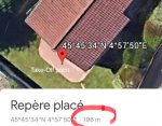
The Altitude of my home take-off point for example is 196 m. the height is ‘0 m’
The flight height will be ‘30 meters’ for example, and the flight altitude will be 196+30 = 226 m. So we need to keep the ‘30’ above the ground, just change the label of the field to ‘height’ instead of ‘altitude’
That leads me to a request : in Google Earth (don’t know about google maps), you get the latitude and longitude coordinates of each way point, but you also get the elevation (altitude) of the point (see pictures below).
If you can get this precious information Of each point in your software, it would be great to make a flight path that follows the terrain elevation from waypoint to waypoint.
From google earth Altitude of my take off = 196 m, desired height of the path =30 m.
Next way point Altitude from google earth data is 199 m so automatically calculated height of the way point would be 199-196=3 + 30= 33 m
that would be a great way to follow the slope of the terrain for a orthomosaic photo (a grid path) ! This is something Pix4DCapture does not do !
You would of course need a radio button that states ‘
Good job anyway !
Google earth App :

This Flight Plan preparation and points generation is perfect for people who want to film or take still pictures of a POI or a path... it improves almost day by day depending on the users requests and you take all remarks into account ! Bravo !
I’d just like to propose a little correction (and of course ... I have a request for you ;o).
First, what is called ‘Flight Altitude’ seems to be in fact the ‘Flight Height above the Take-Off point’. The ‘0 m’ point is defined by the Anafi Barometer at startup/take-off.
The Altitude of my home take-off point for example is 196 m. the height is ‘0 m’
The flight height will be ‘30 meters’ for example, and the flight altitude will be 196+30 = 226 m. So we need to keep the ‘30’ above the ground, just change the label of the field to ‘height’ instead of ‘altitude’
That leads me to a request : in Google Earth (don’t know about google maps), you get the latitude and longitude coordinates of each way point, but you also get the elevation (altitude) of the point (see pictures below).
If you can get this precious information Of each point in your software, it would be great to make a flight path that follows the terrain elevation from waypoint to waypoint.
From google earth Altitude of my take off = 196 m, desired height of the path =30 m.
Next way point Altitude from google earth data is 199 m so automatically calculated height of the way point would be 199-196=3 + 30= 33 m
that would be a great way to follow the slope of the terrain for a orthomosaic photo (a grid path) ! This is something Pix4DCapture does not do !
You would of course need a radio button that states ‘
Good job anyway !

Google earth App :


Similar threads
- Replies
- 7
- Views
- 2K
- Replies
- 0
- Views
- 269


