Welcome to our Community
Wanting to join the rest of our members? Feel free to sign up today.
Sign up

Translating Litchi missions to Flight Plan (FF6) missions.

Ok, I have a couple of ideas how to find out the differences between behavior from litchi to Anafi converted flight plans

Actually, the different outcome in the beginning of my flight, the Spark did look to the horizon, the Anafi straight down to the POI for the first circle, points in some direction I think!

In Litchi, I did set the wp's to POI 1, but disabled the gimbal pitch.
The Anafi however looked straight down to the POI
And:
Did not stopNgo on that first round!

StopNgo started afterwards, and that is to see in the flight plan:
There where you can see the green mark in the flight plan, which is the angle for the gimbal pitch!
(I found an older videos "could not make that work at all", so ...., delete!)

I have saved the same flight plan now WITHOUT the gimbal pitch presets
Since the Anafi is pointing on to the POI, to the selected height of the POI anyway, I can see here a chance, that the bird will now fly freely around. Knock on wood.
(Unlucky, I saw some anafi videos, where the bird slowed still a bit down, at wp's)

I hope to test that 2morrow or the day after.
Also I think, to just have to let the Anafi fly around a POI by "watching" the horizon, we'll have to set the wp's to the POI and unset 'em afterwards, again. Cam direction stays, but Angle up to "0", methinks

Also I made some little adjustments for major changes (switching from POI to POI), with using 2 or 3 waypoints, to change the camera direction a bit slower over 2 or 3 steps.

Also I managed to create a kind of similar flightplan in FF6, on my tablet.
Will fly that one for evaluation too.

But: It really needs so much more time, to get somewhere with it.
Ok, I am certainly not that experienced in FF6 flightplan planning, but aside that I would need a 10+" tablet, to have all points on the screen, it is really slowing down the planning. Compared to the mission hub setup on a Computer.
And don't hit a wp by accident, during you moving the screen ;-)

Will report more, after I have executed this test.
 
So, here we go.

I flew 3 Anafi flight plans, today.
But only inserted 2 of them in the video, plus the stopNgo from sunday.

Don't let the 16 times speed fool ya: There are still stops, or speed reducings, IN ALL 3 flight plans. Perhaps I should do a side by side in 1x or 2, 4x speed.
Will see later.
Oh, on the FF6 flight plan, I even changed the height from some wp to some other wp. That worked well!


Top left is a one / one conversion. That does not work very well, the Anafi almost stops at every waypoint b/c Litchi has gimbal angle settings in its missions. In FF6, after wp is assigned to a POI, the drone points the camera automatic to the PO/height of interest. But not showing/needing them in the plan.

Top right is the same mission, I just deleted all the gimbal setup from the flight plan, but not the last 20. So it first is smoother, in the end it proves: Gimbal / pitch is a double setting, which confuses the Anafi, it has to stop/slow down.

So either don't assign Gimbal /pitch "focus POI" in Litchi
or
change the wp assignment in the FF6 without touching the direction of every wp.
;-)

On the bottom right, that is a FF6 generated mission, not identical, but I tried hard, to get close to the other two missions. Just to compare the outcome, which is nice, just a lot more work, to get there. On a tablet, at least!
Just:
Even if not stopping, it is really slowing down. Mostly. Not at all wp's
Also, Anafi flight plans don't do smooth transitions from one POI to the other.
Like DJI's are.
All happens at the waypoint, coming from another, zoooooooom, to the next.

I hope, I am getting somewhere with this.
The Anafi is really keeping the POI in focus, stabil.
But the slow, quicker, slow is not really a good thing to capture single shot scenes with the Anafi. Not in a flight plan, as it looks for me, right now!


And look at the ending position from the top videos.
That GPS is working very well, methinks!
 
Last edited:
  • Like
Reactions: zandoli
Another question. Did you have above ground enabled for waypoints? And if so do you feel it worked?
My key worked, how is it with yours, now?

Ehm, I am trying to build up some trust in ground enabled waypoint missions. :rolleyes:
But right now I am a bit concerned about that the altitude is not corresponding with the sat-pictures on google.
Which at least should keep people away from planing to little flight heights over ground. (Me?)

I did set up a plan in litchi.
Actually, I used google earth for the path , following this video, and imported the .kml into litchi, after.
Not sure that has advantages, but I did look into this before.
After I saved it as kml, imported that to Litchi, created the mission settings (POI, ....).
Exported that as CSV, did the conversion with CSV2JSON and got a savedPlan.json PLUS a savedPlanagl.csv
(where did that come from?)
Imported the json into FF6, and looked at the agl.csv in Litchi

I have not flown that mission, yet.
And I will (have to) do different settings, before I do, b/c the height of 20m should have shown the above ground effect, but could get me on some wp's (7 to 8) in trouble.
Because on the reservoir (like on beaches), there is very good to see, that the elevation from google is not on the spot!

I think, the drone will fly more or less the path, that is to see, in the pictures.
Which sees the highest ground on the water. But even if the reservoir would be full, it would be some meters under the top of the dam.
Also I would assume that I end up in the trees, despite that the ground near the road is as high/low, as the tree ground is.
But: the elevation numbers on google still got lower behind the road.
That said, with 40 or 50 m flight height it will work out, I think.

But I will "loose" wp7 and 8/9, for flying it with the set up of 20m

And I really wanna see, if this way the Anafi could fly a mission lower than starting point ;-)
But since there a light poles on the dam, I try not to push it to much in the beginning.

Here the pictures to the project:

Google Earth Pro Path:
earth-pro.jpg

Litchi from Google Pro plus POI, all wp's focus POI
Litchi.jpg

Litchi from agl.csv after conversion for FF6
AGL-csv.jpg

Mission from Litchi shown in FF6
FF6.jpg


I hope that I can fly this soon. Will today change the mission a bit, deleting 7 and 8, perhaps 9, and then wait for the right time.
 
Last edited:
Done the flight with the Anafi, today
20m AGL Mission,
AGL.jpg
It works, but on the Anafi, it is not so good to see.
The mission focus POI setting wasn't that good for it.
But still, it is working
And the 25m in the end, the reservoir is higher, as the dam is . In Google, at least ;-)
 
So, next step would be to try flying the mission from a higher ground to a lower ground.
On the paper, this should be possible.:
Li.jpg
FF6.jpg

How that will work out in reality: I can't say, yet.
I am looking for a reachable hilltop with a nice long slope and no water, anywhere ;-)

But: Has anyone a solution against the stop and go, at wp's?
Any hack, to let the Anafi travel smoothly through them?
 
I think the pausing in flightplans needs to reported to Parrot, it spoils the whole purpose of flightplans.

Anyone worked out what exactly triggers the pausing? is it changes to the camera angle, or even switching to POI causing it?
 
Last edited:
  • Like
Reactions: Peio64270
Seems, that Parrot has ignored this for almost a year:
 
Seems, that Parrot has ignored this for almost a year:

Hi Anna789,

I see only today your tests with CSV2JSON.

I usually do not use "Focus POI" in my Litchi missions. When needed, I drop a temporary POI for fixing the camera angle with "Focus POI" and then, I delete it and I change the setting to "Interpolate".
I prefer the "Interpolate" setting in my DJI missions since I find it gives smoother transitions from one waypoint to the next than "Focus POI", specially when POIs are not the same to focus at two consecutive waypoints. Thus I can only speak about my experience with Litchi missions with "interpolate" setting converted into Flight Plan missions where I didn't see this slow down or stop and go (no more I mix "Interpolate" with any other gimbal mode).

What I can suggest is first to verify that the speed chosen for the changes in camera pitch is compatible with the planed angle changes and the time allowed for them between two waypoints (this being related to the drone speed). From memory, this speed can be set from 1°/s to 180°/s. By default in "Film" mode, it is 10°/s which should be enough in most situations.
Second, I'd try to reduce the curves in Litchi.(while keeping the "curve" mode). Apparently, Flight Plan has no curves at waypoints and therefore it has no "virtual" waypoints calculated in order to drive the drone around these curves. How far this can make a difference in pitch changes calculation, I don't know.

The last thing is that gimbal pitch changes are calculated "live" by Litchi app during the mission flight (they are not stored in the drone memory) and I don't know how Flight Plan proceeds for this task. This could also make a difference.

Please let me know if you discover something new. I'll look more thorougly at your problem as soon as I have time.
 
Right now I am a bit on hold.
I need a new location, with a bit more space to test agl better.
Near the dam, every altitude change has to be done more precise
Which needs a lot of calculating about speed and ascending/descending speeds.
To not get to close to something ;-) like in the attached video.
That was a flown mission, meaning I flew it with a Spark and did set the wp's midair.
Not even a AGL mission, since I have really no trust in the elevations on google, if this close to the highest/lowest point and such.
But still after the setup, I flew that mission the 2. time, now in auto mode, and thought: that'll do

It didn't.
And the Spark turned, so it was grey on grey. ;-(
The sun to bright for the red lights and the camera live view showing only some "gras" and the sky.
I needed 20 minutes to find it. Even being in the 5meter radius, I almost had to step on to it!
Should have switched to the Go4, after uploading the mission. Would have given me a beepbeep option.

And yes, the Focus POI is not really helping.
Like I wrote, it changed to the better, after I deleted camera pitch setups in the flight plan.
But still, the speed is going up after the latest and down just in front of the next wp
So my guess, the flight plan speed is part of it. Like the angle of the direction change.
And how close the wp's are to each other. As closer, as better, I think. Less speed changes possible
Reducing them, meaning planing more wp's (Anafi says something from 4 for a 90degree change, I think) in a curve, will assumingly help.
Still a lot to test out.

To the gimbal pitch changes, I think that flight plan is doing the same, calculating in the app.
On litchi, I can see that live, switching from litchi to a Go4, which will download the mission, but keep the gimbal where it is in the moment of the "pause the mission". For manual adjustments afterwards
At flightplan , I would need to disconnect at least the device from the remote, to test that out.
And can see it only in the video from the SD, later.

And I will check on the interpolate thing soon
But the gimbal is/was pointing very well on the POI, in the mission.
Yep, still a lot to test.
I just need a better location with a big(ger) altitude change for some more distanced flight from the ground and obstacles, to play with one mission and just changes in it.

I am looking for one !
 
Hi Anna789,

I see only today your tests with CSV2JSON.

I usually do not use "Focus POI" in my Litchi missions. When needed, I drop a temporary POI for fixing the camera angle with "Focus POI" and then, I delete it and I change the setting to "Interpolate".
I prefer the "Interpolate" setting in my DJI missions since I find it gives smoother transitions from one waypoint to the next than "Focus POI", specially when POIs are not the same to focus at two consecutive waypoints. Thus I can only speak about my experience with Litchi missions with "interpolate" setting converted into Flight Plan missions where I didn't see this slow down or stop and go (no more I mix "Interpolate" with any other gimbal mode).

What I can suggest is first to verify that the speed chosen for the changes in camera pitch is compatible with the planed angle changes and the time allowed for them between two waypoints (this being related to the drone speed). From memory, this speed can be set from 1°/s to 180°/s. By default in "Film" mode, it is 10°/s which should be enough in most situations.
Second, I'd try to reduce the curves in Litchi.(while keeping the "curve" mode). Apparently, Flight Plan has no curves at waypoints and therefore it has no "virtual" waypoints calculated in order to drive the drone around these curves. How far this can make a difference in pitch changes calculation, I don't know.

The last thing is that gimbal pitch changes are calculated "live" by Litchi app during the mission flight (they are not stored in the drone memory) and I don't know how Flight Plan proceeds for this task. This could also make a difference.

Please let me know if you discover something new. I'll look more thorougly at your problem as soon as I have time.


Any chance of getting one written with imperial measurements? Or a option to change back and forth? It would make my life a lot easier :)
 
How comes, that north american people still hang in the British Imperial System ?
Is that Freud?
;)
 
How comes, that north american people still hang in the British Imperial System ?
Is that Freud?
;)

I am 63 years old. Canada went to the metric system after I finished school and imperial just seems more natural to me for some things but not all. If travelling in my truck I have no problem with Km\h but judging distance and height I prefer imperial. Just a grumpy old man that does not like change.
geezer.gif
 
Hi Anna789,

I see only today your tests with CSV2JSON.

I usually do not use "Focus POI" in my Litchi missions. When needed, I drop a temporary POI for fixing the camera angle with "Focus POI" and then, I delete it and I change the setting to "Interpolate".
I prefer the "Interpolate" setting in my DJI missions since I find it gives smoother transitions from one waypoint to the next than "Focus POI", specially when POIs are not the same to focus at two consecutive waypoints. Thus I can only speak about my experience with Litchi missions with "interpolate" setting converted into Flight Plan missions where I didn't see this slow down or stop and go (no more I mix "Interpolate" with any other gimbal mode).

What I can suggest is first to verify that the speed chosen for the changes in camera pitch is compatible with the planed angle changes and the time allowed for them between two waypoints (this being related to the drone speed). From memory, this speed can be set from 1°/s to 180°/s. By default in "Film" mode, it is 10°/s which should be enough in most situations.
Second, I'd try to reduce the curves in Litchi.(while keeping the "curve" mode). Apparently, Flight Plan has no curves at waypoints and therefore it has no "virtual" waypoints calculated in order to drive the drone around these curves. How far this can make a difference in pitch changes calculation, I don't know.

The last thing is that gimbal pitch changes are calculated "live" by Litchi app during the mission flight (they are not stored in the drone memory) and I don't know how Flight Plan proceeds for this task. This could also make a difference.

Please let me know if you discover something new. I'll look more thorougly at your problem as soon as I have time.

I have an Idea!
I think it can help to look at original flight plans in Litchi!
Is it difficult, to build also an JSON2CSV prog?
:unsure:
 
Yes one of the members from the Autelpilots forum @Franlic posted the heavy snow they got around his village and the power is still out in some places he said,

I’m in Lyon (50 km from him, but at a lower altitude (200 m).
Yesterday was so warm an sunny, we had a 2 hours hike with 20°Celsius.
Some paths are still flooded though...
5F38C74A-BE73-43DB-8547-03F5BE018DB2.jpeg
 
... Back to this fantastic thread ... I've just understood this WebApp could help me do exactly what I need :


- Plan survey mission in the shape of a "Lawn Mower" path in Litchi Hub (I found pre-made Lawn Mower Paths in KML an other WebApp called HiveMapper) ... but this kind of mission should follow the terrain slope (I use Pix4Dcapture, that is great to program quickly grid missions but it stays "flat")
- Export them to Google Earth Pro to check no error
- Convert them to JSON files to load and fly them in FF6.

So I manage to program a test mission but I face a few problems :

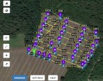
This kind of mission requires taking pictures at Nadir ("Perpendicular" to the groud) for a big number of pictures ... so I can shift+left click and choose all picture one by one and do a "batch edit" as the new window appears ... Is there a way to "SELECT ALL WAYPOINTS" in LITCHI HUB ?

I'll have to find a way to pre-programm grid missions depending on pix/meter, height of flight and overlap percentage, like PixCapure4D does. Any idea ?

Below, images of my fist test :

LITCHI HUB
LitchiPlanning0.jpg

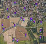
Google Earth view (we see it follows the slope of the field for 3D/2D mapping), still I have error points I need to correct (no "Select All Option in Litchi ?")
LitchiPlanning.jpg

...and for information, the exact same mission, planned with Pix4Dcapture, with 2 missions at different level ... as we can't follow a slope with Pix4Dcapture !
Pix4Dcapture.jpg
 
Last edited:
3 or 4 years ago on the Autelpilots forum we were trying to solve how we could do mapping with the Autel X-Star. We had to come up with all the camera info to fill in the blanks but we managed. Not sure if this will be useful to you MustangPhil but here is a Ortho guide PDF for the PIX4D calculator. It was made X-star so not sure if it will be helpful or not.
 

Attachments

  • 1_XSP_Ortho_Guide.pdf
    191.7 KB · Views: 19
  • Like
Reactions: MustangPhil
Thank @Agustine ... that’s an excellent starting point !

I may end-up following the process :
- Making a flight plan in kml 3D with any tool that allows making a grid path.
- import it to Google earth, edit and save in 3D kml.
- import in Litchi hub then export to JSON...
 
I started modifying the Excel file from Pix4D with a part of SONY MX220 sensor data and the hFOV data for JPEC Rect pictures from PARROT.
Did some maths and compared it to reality.

There might be a little error but I'm not far from the real pixel count of the reality and the 1 cm/pixel given by Pix4Dcapture with the Anafi flying at 35 m...

I also joined the modified Excel File for ANAFI (beware, the focal distance is 4 mm for DNG and ... different (as well as the image size) for the Rectified JPEG in ANAFI (I suppose you did not have 2 different FOV with the Autel Drone). Made a Zip file as xls cannot be attached.
The final Excel is for rectified JPEG 4:3 images from the ANAFI that work great for mapping from my little experience ...
CalculAnafiFOVjpegRect.jpg
 

Attachments

  • AnafiFOV_Calculator.zip
    103.1 KB · Views: 10
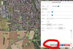
... Yes, and I've just remarked that you can also SELECT ALL in Litchi Mission Hub !!
The process is the following :

- All your mission points are placed.
- Select one point just clicking on it, then hold CTRL (on PC) and click on a second point.
- When you have your 2 points selected, The menu changes from "Way Point setting" to "Batch Editing"
- There IS a button "Select All", click on it ...
- Then you can choose "Altitude" for example 35 meter and tick the check box "Above ground".
- Click "Apply" ... and tadaaaaa ... all way points are 35 meters above the ground (with height above take-off point in parenthesis).

... I'm going to enjoy the free Litchi Hub ... !

Litchi Select All.jpg

Then After Height selection and "Above Ground" selection, Apply:
Litchi Apply.jpg
 

Members online

No members online now.

Forum statistics

Threads
5,306
Messages
45,088
Members
8,002
Latest member
lustar